Located in north-central geopolitical zone of Nigeria, Niger State was created out of the defunct North Western Nigeria in 1976 and it is divided into twenty five local government areas which include Agaie, Agwara, Bida, Borgu, Bosso, Chanchaga, Edati, Gbako, Gurara, Katcha, Kotangora, Lapai, Lavum, Magama, Mariga, Mashegu, Mokwa, Muya, Paikoro, Rafi, Rijau, Shiroro, Suleja, Tafa, and Wushishi.
History
The area known as Niger State today was originally part of the defunct North Western State which was one of the twelve states initially created in 1967. The old state was later divided into two by late General Murtala Muhammed’s regime in 1976 and this brought about Sokoto and Niger states. The present Niger State is the largest state in the country in term of landmass and referred to as the “Power State” because of the existence of three hydro-electric power stations namely the Shiroro, Kainji and Jebba power stations in the state.
People & Culture
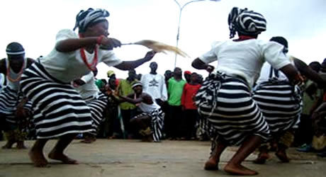
Niger State has an estimated population of about 3,950,249 as at 2006. The three principal ethnic groups of the state are the Nupe, the Gwari and the Hausa. Other groups include the Koro, the Kadara, the Kambari, the Kamuku, the Pangu, the Bassa, the Bauchi, the Fulani, the Dukawa, the Gabo, the Godara, the Ganagana, the Mauchi, the Ayadi, the Ingwai, the Dido, the Kadanda, the Gulengi, the Abi Shiwa and the Shigini.
The Nupe are found in Gboko, Lavun, Bida, Bia, Agai and parts of Moriga, while the Gwari, Kadara and Koro occupy Suleja, Chanchaga and Shiroro, the Kambari are found in Mariga, Magama and Rafi local government.
[tab:Geography] The State lies on the 3.20° East and longitude 11.30° North covering a total land area of 76,363km/74,244 sqkm. Kaduna State and FCT are her borders to the north-east and south-east respectively; Zamfara State borders the north, Kebbi State in the west, Kogi State in the south and Kwara State in the south-west, while the republic of Benin her north-west.
Weather/Climate
Niger State experiences distinct dry and wet seasons with annual rain fall varying from 1,100mm in the northern part to 1,600mm in the southern parts. The maximum temperature (usually not more than 940°C) is recorded between March and June, while the Minimum is usually between December and January.
The rainy seasons last for about 150 days in the northern parts to about 120 days in the southern parts of the State. Generally, the fertile soil and hydrology of the State permit the cultivation of most of Nigeria’s staple crops and still allows sufficient opportunities for grazing, fresh water fishing and forestry development.
Cities & Towns
Other important cities and towns include Bida, Minna, Suleja, Kotangora, Lapai, and Mokwa etc.
Brass/Glasswork, Bida: Famous for its hand crafts and colourful market, this principal city of the Nupe people is an important city for glass beads, clothes, silver and brass work, it carved eight-legged stools made from a single piece of wood and decorative pottery.
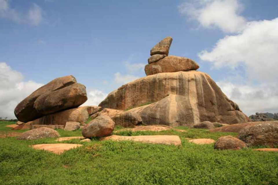
Zuma Rock: This is a beautiful, giant rock used for defensive purposes by the Gwari natives against invading neighbouring tribes during the inter tribal wars. The rock is believed to possess certain powers which rendered enemies powerless and provided the natives with a good hiding place. As the tourists nets closer, a human like face becomes visible with engraving representing the sockets, the nose and the mouth on the side of the rock that faces Abuja road. Zuma rock represents a beautiful and unique natural work of rock formation. It offers a good environment for picnics and relaxation.
Zuma Rock Village: Zuma rock Nigeria Village is situated a few distance from the foot of the Zuma rock and it depicts the village settings of the Gwari natives.
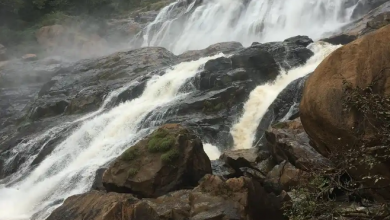
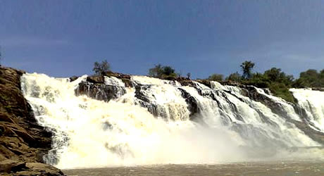
Mayanka Falls: Mayanka fall is one of the nature’s gift surrounded with lush vegetation and appreciative landscape.
Shiroro Dam Tourist Resort: Shiroro Dam is one of the hydro electric dam stations that generate electricity for the nation. A section of the dam was transformed to resort for visitors and tourists who come to visit to have fun, relaxation and leisure.
Bina Footprints: These footprints could be seen on the hill top in Bina village near Muye some kilometers east of Lapai. The footprints also called (Dauda Woyaba) footprints are also believed to be that of Dabo who started his journey from Bina, later went to Gulu, performed his ablution and built his mosque, stayed for some times before leaving for Kano. The footprints are still visible on the rock at Bina hilltop.
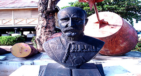
Nagwamatse Well: This well is said to have been dug by the legendary Nagwamatse during the Jihad. It has been related that when he was resting under a tree, he struck the ground with his sword in order to get water for ablution in preparation to perform his prayers. The water spot that resulted from that action still exists as a well some kilometres away from Kontagora.
Dr Ladi Kwali Pottery Centre: Established in 1951 by late Mr. Micheal Cardew, a British potter of international repute. The centre trains native traditional potters in the art of modern pottery making in order to preserve and protect Nigeria’s rich cultural heritage through the art of pottery making. A good centre for tourist to purchase souvenirs.
Kainji Lake National Park: Established in 1979 by the merger of Borgu and Zugurma game reserves which covers an area of 5,340sq km, Kanji Lake National park is one of the largest parks in Nigeria and West Africa. The park is closely linked with the famous Kainji lake hydro electric complex and it is one of Nigeria’s inland jewels and contains a wide variety of Nigeria’s floral and fauna resources. Kainji Lake Park boasts of abundant wildlife such as antelopes, lions, hippopotamus, buffalo, roan antelopes, baboons, monkeys, duikers, crocodiles, elephants etc.
Other attractions
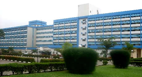
[tab:Eating Out] Not yet posted [tab:Shopping] Bida Market: Bida market truly stands out as a traditional showcase of local commerce in Niger State. This is where locally made souvenirs range from earrings, bangles, rings, trays, plates, walking sticks, brass toys etc are sold. [tab:Hotels] Shiroro Hotel: Located in Minna, the hotel offers well-furnished rooms with air-conditioning, cable TV, writing desk, bedside lamps, internet access etc. Address: Southern-bypass, Minna. Tel; +234 (0)66-222498[tab:Gallery] Not yet posted [tab:END]